


Breaking News
 Former Special Counsel Robert Mueller Dead at 81
 US authorizes temporary delivery, sale of oil originating from Iran
 How the World Changed Into the NWO
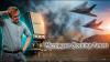
 $200 Billion for War and $20 Million to Destroy the Last Congressman Who Says No
Top Tech News
 We Build and Test Microwave Blocking Panels - Invisible to Radar
 Man Successfully Designs mRNA Vaccine To Treat His Dog's Cancer
 Watch: Humanoid robot gets surprisingly good at tennis
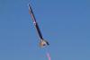 Low-cost hypersonic rocket engine takes flight for US Air Force
 Your WiFi Can See You. Here's How.
 Decentralizing Defense: A $96 Guided Rocket Just Put Precision Warfare into the Hands of the People
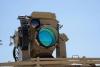 Israel's Iron Beam and the laser future of missile defense
 Scientists at the Harbin University of Science and Technology have pioneered a sophisticated...
 Researchers have developed a breakthrough "molecular jackhammer" technique...
 Human trials are underway for a drug that regrows human teeth in just 4 days.


Spying from space: New satellite can produce "crystal clear" images of any place on Earth
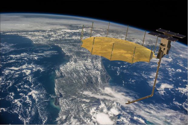
Called Capella-2, the bedroom-sized satellite beams radio signals that can penetrate imaging barriers like cloud cover and nighttime to produce high-resolution radar images that show the inside of lightweight structures.
Capella Space launched the satellite to space in August but has only unveiled it this December. When asked about privacy concerns, the company stated that the device cannot be used for spying even though it's better at viewing Earth than other surveillance and observational satellites.
The best satellite yet of its kind
Capella-2 is about the size of a washing machine when launched into orbit. But it grew to the size of a small bedroom after deploying a minivan-long boom upon reaching space. It is equipped with an impressive system of cameras and sensors, boasting more than 1,300 feet of cables and wiring linking more than 100 individual boards and electronics.
"The whole system is nothing short of remarkable," said Capella Space CEO Payam Banazadeh, a former engineer at the National Aeronautics and Space Administration (NASA)'s Jet Propulsion Laboratory.
The satellite uses an imaging method called Synthetic Aperture Radar (SAR). SAR is the same technology NASA has been using since the 1970s. It can view Earth regardless of air visibility, cloud covering or time of day. It does this by blasting 9.65 gigahertz radio signals toward the planet and interprets the pulses that bounce back to form a visual.
"At that frequency, the clouds are pretty much transparent. You can penetrate clouds, fog, moisture, smoke, haze," Banazadeh told Futurism.