


Breaking News
 Which party represents Americans?
 Even The Best AI Scenario Is The End Of Everything We've Ever Been
 In Simulated War Games, Top AI Models Recommended Using Nukes 95% Of The Time
 Rising Cancer Rates, the Globalist Agenda, and the Big Business Land Grab Making You Poor
Top Tech News
 New Spray-on Powder Instantly Seals Life-Threatening Wounds in Battle or During Disasters
 AI-enhanced stethoscope excels at listening to our hearts
 Flame-treated sunscreen keeps the zinc but cuts the smeary white look
 Display hub adds three more screens powered through single USB port
 We Finally Know How Fast The Tesla Semi Will Charge: Very, Very Fast
 Drone-launching underwater drone hitches a ride on ship and sub hulls
 Humanoid Robots Get "Brains" As Dual-Use Fears Mount
 SpaceX Authorized to Increase High Speed Internet Download Speeds 5X Through 2026
 Space AI is the Key to the Technological Singularity
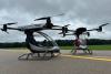 Velocitor X-1 eVTOL could be beating the traffic in just a year


Ex-Google Maps PM Vibe Coded Palantir In a Weekend (Palantir Noticed)

My latest coding project started trending on X and people were sharing it saying I vibe coded Palantir. Then the actual Palantir co-founder weighed in. His take? I'm missing real proprietary data fusion. Fair, but the fact that it's even being discussed shows exactly where these models are right now.
This is WorldView. I built it in three days with an army of AI agents and publicly available data feeds. Live satellite tracking, military aircraft via ADS-B, real-time CCTV projected onto 3D geometry, seismic data, and street traffic; all running against Google's 3D tiles and skinned with CRT, night vision, and FLIR filters. Basically what happens when Google Earth and Palantir have a baby.
In this video I walk through every data and break down the setup I used to build it. What you can build today between Gemini 3.1 and Claude 4.6 is insane. If you've got domain expertise, this is the time to put it to work.
Chapters:
0:00 - It went viral overnight
0:49 - Google Earth meets Palantir
1:02 - CRT, Night Vision & FLIR modes
1:24 - Camera presets & landmarks
2:23 - Live satellite tracking (every satellite in orbit)
3:12 - Real-time flight data (6,700+ planes)
4:25 - Military flight tracking via ADS-B
5:26 - Street traffic simulation
6:37 - Real-time CCTV camera feeds
8:02 - Earthquake & seismic data
8:25 - The AI coding tools I used
8:45 - Running agents in parallel
9:54 - Now is the time to build stuff yourself